


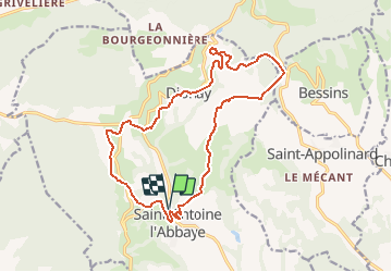
De Saint-Antoine-l'Abbaye à La Trappe par la voie du tram

raymondfn
User

Length
17.6 km

Max alt
633 m

Uphill gradient
452 m
Km-Effort
24 km

Min alt
357 m

Downhill gradient
452 m
Boucle
Yes
Creation date :
2021-03-27 08:42:06.679
Updated on :
2021-03-27 17:42:57.775
5h25
Difficulty : Very difficult

FREE GPS app for hiking
 SityTrail
IGN / Geographical institutes
SityTrail Plus
The world is yours!
About
Trail Walking of 17.6 km to be discovered at Auvergne-Rhône-Alpes, Isère, Saint-Antoine l'Abbaye. This trail is proposed by raymondfn.
Positioning
Country:
France
Region :
Auvergne-Rhône-Alpes
Department/Province :
Isère
Municipality :
Saint-Antoine l'Abbaye
Location:
Saint-Antoine-l'Abbaye
Start:(Dec)
Start:(UTM)
673980 ; 5005013 (31T) N.
Comments